
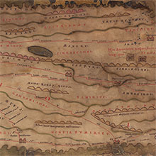
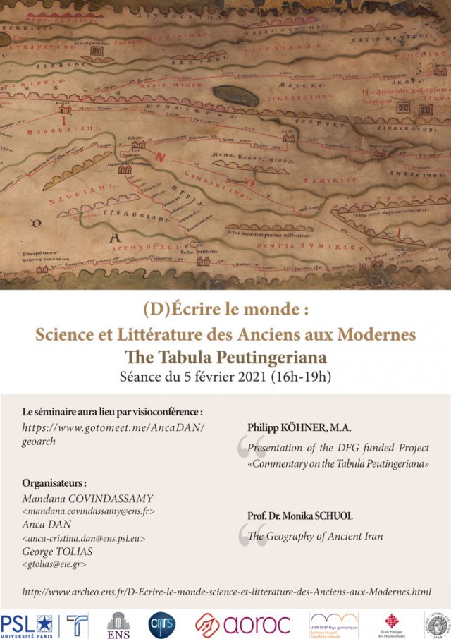
The Tabula Peutingeriana
Philipp Köhner &
Monika Schuol
Philipp Köhner &
Monika Schuol
Vendredi 5 février 2021, 16h-19h
Visioconférence: https://www.gotomeet.me/AncaDAN/geoarch
Par téléphone: +33 187 210 241
Code d’accès: 906-762-757
Conférence dans le cadre du séminaire “(D)Écrire le monde : Science et Littérature des Anciens aux Modernes”
- Philipp Köhner, M.A.
Research assistant at the Chair of Ancient History at the Catholic University of Eichstätt-Ingolstadt (since August 2019). Field of study: Classical Philology and History (2012-2019), Master’s thesis in Ancient History (2020) on “North Africa on the Tabula Peutingeriana”.
Presentation of the DFG funded Project«Commentary on the Tabula Peutingeriana»
- Prof. Monika Schuol
Researcher at the Chair of Ancient History at the Catholic University of Eichstätt-Ingolstadt (since October 2017). My research interests comprise all ages of the antiquity and particularly the cultural exchange between Orient and Occident with a focus on its transformation processes. PhD-thesis: “Die Charakene. Ein mesopotamisches Koenigreich in hellenistisch-parthischer Zeit” (2000), Habilitation: “Augustus und die Juden. Der Umgang mit einer Minderheit im Spiegel rechtsgeschichtlicher Entwicklungen am Beispiel Kleinasiens” (2005).
The Geography of Ancient Iran
The representation of the eastern segments offers a lot of irritating geographic informations: For instance, Ekbatana seems placed on the shore of the Persian Gulf and some roads in eastern Mesopotamia are ending in the nowhere. A special eye-catcher in the eastern part of the oikumene is the depiction of a giant hydrographic net connecting (contrary to the geographic reality) the Indian subcontinent with the Euphrates-Tigris-region.
Focusing on the large geographic areas between Mesopotamia and India an attempt will be made to assign these modifications to different chronological phases in the long copying process. I will also raise the question as to whether and to what degree the representation of the geography of ancient Iran in the Taula Peutingeriana is part of a larger medieval cartographic tradition.
Responsables : Mandana Covindassamy, Anca Dan & George Tolias